Getting back To Fire Suméŝ: Exploring A Multi-Disciplinary Approach To Incorporating Traditional Knowledge Into Fuels Treatments
The Leopold Institute and the Elouise Cobell Land and Culture Institute at the University of Montana provided “fuzzy GIS” support to the Collaborative Forest Landscape Restoration Program in Washington. In this project to evaluate fuel treatment effectiveness, led by the Colville National Forest and the University of Idaho, there was need to incorporate Confederated Colville Tribal member views regarding the location and effectiveness of fuel treatments within their ancestral territory inside the National Forest boundary. This paper demonstrates how incorporating Traditional Knowledge into fuels treatments through use of Participatory Geographic Information Systems (PGIS) can improve ongoing adaptive management of national forests that include tribal ancestral lands.
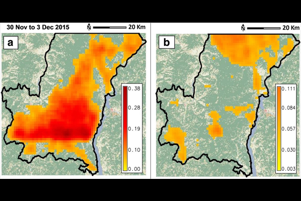
The maps show areas where PGIS participants felt that fuels treatments could be applied (A), and where fuels treatments should be avoided (B) on the Northeast Washington Collaborative Forest Landscape Restoration Area project area of the Colville National Forest, USA. The color scale on the lower right corner of the maps represents the proportion of PGIS participants that identified an area as benefiting from treatments or as a place where fuels treatments should be excluded for which 0 is none of participants and 1 is 100% of participants.
The research article is open and can be accessed here.